Geology MSc

Sudan
Geology MSc
Geologist
Degree program
Master
FNYF/168-3/2016
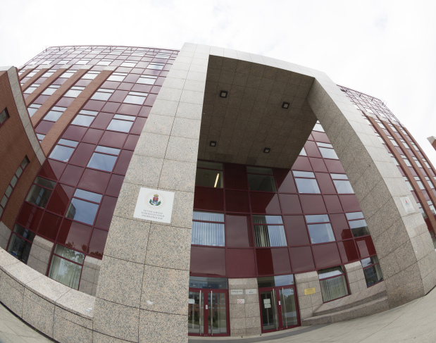
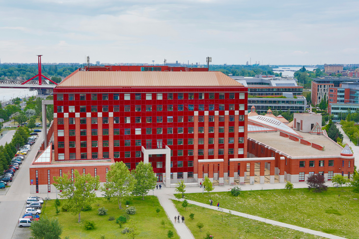
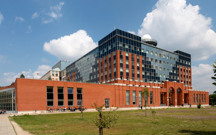
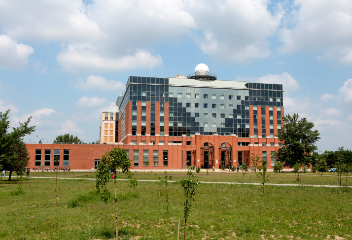
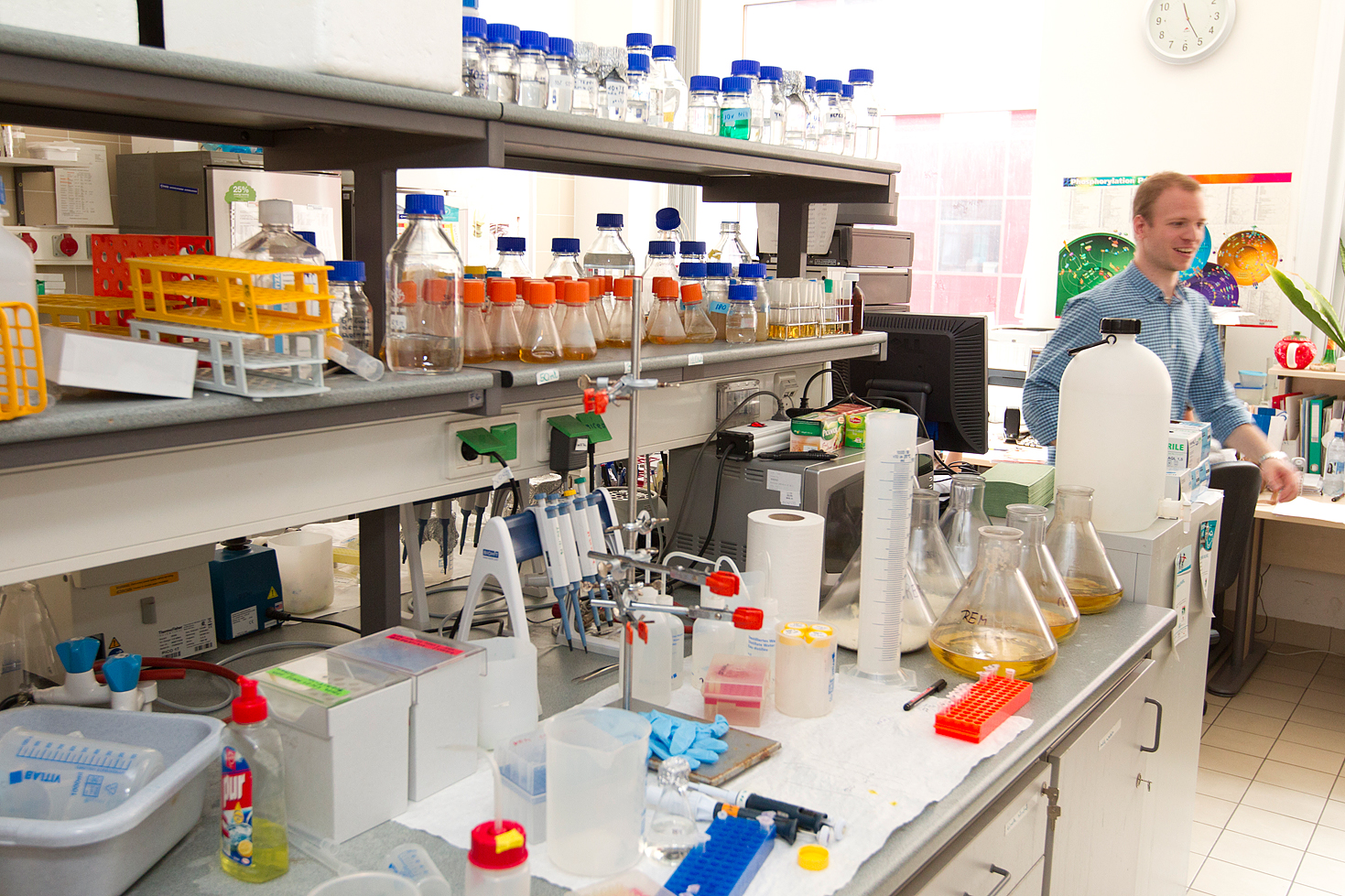
Institute of Geography and Earth Sciences
Department of Physical and Applied Geology
Center of Earth Sciences
English
4 semesters (2 years)
120
6
12
The program provides advanced training in geology, applicable to geological problem solving. Our graduates have a solid foundation of knowledge in the different core disciplines of geology sciences (mineralogy, petrology, geochemistry, and paleontology), complemented with advanced skills through specialized studies in selected areas. The field component includes a three-week geological mapping field school.
The program also has an emphasis on practical courses related to mineral exploration, petroleum geology, hydrogeology and environmental geology. The specialization in petroleum geology and/or hydrogeology provides in-depth training for future specialists in these fields. The degree program prepares both for continuing studies after admission to a doctoral program and work as a geologist primarily in the petroleum industry, in hydrogeology, or in related jobs in the public sector.
The Geology MSc program is taught by highly qualified faculty members of four departments (Physical and Applied Geology, Mineralogy, Petrology and Geochemistry, and Paleontology). The Program Director is a member of the Hungarian Academy of Sciences, six professors hold the doctoral degree of the Academy, other teaching faculty members hold PhD degrees. Three research units, specialized in topics of geology and paleontology, are funded by the Hungarian Academy of Sciences, and hosted by the Institute of Geography and Earth Sciences.
The highly diverse research portfolio of our staff is focused on (but not restricted to) the geology of Hungary, the Pannonian Basin and the neighboring areas, its hydrocarbon and groundwater systems, mineral resources, as well as basic research in mineralogy, geochemistry, sedimentology, stratigraphy and paleontology. Results of this research are regularly published in leading international journals, and MSc student thesis projects are often integrated into these larger projects.
Compulsory courses
The most important rock-forming silicates (meso-, soro-, cyclo-, ino-, phyllo-, and tektosilicates), oxides, hydroxides, carbonates, halides, etc., their crystal structure, crystal chemistry, physical properties and genesis for the identification or rocks and understanding their petrogenesis.
- Fossilization of organic and inorganic material. Processes and products. Taphonomy.
- Trace fossils: fossil behaviour.
- Biostratigraphy: subdivision, correlation, and dating of sedimentary rocks by fossils.
- Paleoecology: environments and adaptations of the past. Ecological niches and the succession of organisms filling them.
- Paleobiogeography: distribution of organisms on Earth, recent and past.
- Evolution on micro- and macroscale.
- Paleobiological events and processes: the first evidence for life; origin of protists and metazoans; history of the mineral skeleton.
- Fossillagerstätten: exceptional prservation in the fossil record.
Texture and structure of volcanic and metamorphic rocks; textural and optical characterization of rock-forming and accessory minerals; petrographic features of ultramafic rocks; petrographic features of mafic igneous rocks; petrographic features of intermediate igneous rocks; petrographic features of felsic igneous rocks; petrographic features of pyroclastic rocks; from petrography to petrogenesis: interpretation of igneous rocks based on combined textural and geochemical analysis; petrography of low pT metamorphic rocks; petrography of gneisses and granulites; petrography of eclogites; petrography of sedimentary rocks
Types of geological maps and sections. Strike and dip. Determination of bedding planes from measurements, outcropping points and 3 wells. Dip sections. Construction of map view from dip data. Strike sections. Apparent dips and arbitrary sections. Vertical exaggeration. Map view and sections of unconformities. Map view and sections of folded sequences. Map view and sections of faulted sequences. Determination of offset. Sections constructed from well data. Maps constructed from field data.
Application of principles and abilities gained during the course „Construction of geological sections and maps”. Field observations, measurement of stratigraphic sections, and documentation of an assigned area of mountainous topography and vegetation cover. Critical evaluation of data. Construction of geological cross sections and series of maps (observational data, superficial deposit map, bedrock geological map). Understanding the geological/structural evolution of the study area. Reporting.
- Application of stratigraphic methods in selected case studies.
- Complex lithostratigraphic characterization of geological formations.
- Major groups of age-diagnostic fossils used in biostratigraphy.
- Radiometric dating and magnetostratigraphy integrated with biostratigraphy.
- Paleoenvironments inferred from fossil assemblages.
- Paleoenvironmental changes inferred from stratigraphic successions.
- Chemostratigraphy.
- Geochronology and the geological time scale.
Students get familiar with stereographic projection, basic structural forms and their geological background
Roots and development of sedimentology. Allogenic controls on sedimentation. Facies, sedimentary environments, uniformitarianism, facies models. Bed load transport in unidirectional and oscillatory flows, gravitational mass movements. Laws of deposition. Bedforms in clay, sand and gravel, reconstruction of physical parameters of sediment transport. Sedimentary structures formed by gravitational mass movements. Other sedimentary structures: sole marks, soft-sediment deformation. Palaeoichnology applied in reconstruction of sedimentary environments. Volcanosedimentary processes and products. Facies models of depositional environments: eolian, alluvial, fluvial, wave-dominated and tide-dominated shorelines, siliciclastic shelves, deltas, deep-sea slopes and fans.
Facies,
...
- Geological setting of the Pannonian region in the Alpine-Carpathian-Dinaridic realm; structural units; main evolutionary stages
- Pre-Variscan and Variscan structure evolution. Early Paleozoic formations and history of evolution
- Post-Variscan and early Alpine (Late Paleozoic) structure evolution and related formations
- Opening and closure of Tethys basins and early stages of the Alpine orogeny during the Mesozoicum
- Alpine orogeny and Paleogene basins; onset of the Paratethys evolution
- Evolution of the Pannonian Basin during the Miocene to Pliocene
- Quaternary evolution and related formations
Introduction to the most commonly used analytical techniques of geochemical applications, particularly those used in Hungary. The geochemical data. Sampling and sample preparation. Microprobe analysis: scanning and BSE pictures and determination of composition of mineral phases. Determination of major and trace element bulk rock composition: XRF and ICP-MS analysis. The prompt-gamma and instrumental neutron activation method and their applications. Water in minerals and glasses: the infrared spectroscopy method. In-situ trace element composition of minerals: the laser-ablation ICP-MS technique. Obtaining stable isotope data by mass-spectrometry. Silicate melt and fluid inclusion studies. The RAMAN analysis and its application. Analytical techniques in geochronology. Geochemical
...
Fundamentals of the interaction of gravitationally controlled groundwater flow systems with sediments and rocks within the sedimentary and diagenetic realm will be presented. The related major chemical and physical processes, their manifestations in various sedimentary environments and the preservational potential of such phenomena in the stratigraphic record will be discussed in the from of seminars. Students must carry out independent literature research on selected topics. Based on the critical review of the relevant papers they present their opinion on the selected topic. Presentations are followed by free discussion.
The goal of this seminar series is twofold: (1) To help the students to acknowledge the role of groundwater as a geologic agent in all near-surface
...
The subject is the direct sequel to the B.Sc. subject called Environmental calculations. In the first half of the semester the basic knowledge about data analysis is expanded, with special emphasis put on hypothesis-testing,regression analysis, basics of time series analysis (trend, periodicity, forecasting). Ultimately the handling of missing data and its imputation is learned.
In the second half of the semester, multivariate data analysis is the main topic (variance-, cluster, principal component analyses) taught through environmental examples
The Quaternary Ice Age: History of research, timing, and causes of glaciation. Quaternary glacial sedimentary deposits, non-glacial sediments and their stratigraphy. Loess and soils, geomorphic evolution of mountainous and low-lying terrains. Slope failures. Changes of drainage patterns in Hungary, Eolian and lacustrine sedimentation, groundwater and karst phenomena. Quaternary processes on the tropics. Economic and societal significance of Quaternary research. Methods of Quaternary research, interpretation of aerial photographs, and digital elevation models. Geophysical methods, stratigraphy and dating methods, sea level changes, climate changes, geomorphic evolution in Europe, periglacial areas, widespread Quaternary deposits in Hungary.
Core elective courses for the specialization - Geology and Paleontology
The role of the most important microfossils in the stratigraphy, paleoecology, paleobiogeography. It is based on the their most important taxonomical, systematical, stratigraphical and ecological features. The presented microfossil groups are the followings:
- Calcareous group: calcareous nannofossils, foraminifers, ostracods, otoliths, algae, bryozoans, Calpionellids and Calcisphaeras ;
- Siliceous group: sponges, diatoms, radiolarians, silicoflagellates;
- Organic-walled group: spores and pollen grains, dinoflagellates, acritarch, chitinozoa.
- Phosphatic: conodonts, ichthyolits, micromammals.
The practical workflow for applied micropalaeontology including sample acquisition, preparation and analysis, and interpretation and integration.
The following microfossils are studied as isolated specimens and in thin sections or slides:
- Calcareous groups: calcareous nannofossils, foraminifers, ostracods, otoliths, algae, bryozoans, calpionellids and calcispheres ;
- Siliceous groups: sponges, diatoms, radiolarians, silicoflagellates;
- Organic-walled groups: spores and pollen grains, dinoflagellates, acritarch, chitinozoa.
- Phosphatic groups: conodonts, ichthyolits, micromammals.
- History of biostratigraphy
- The role of biostratigraphy in stratigraphy and geology
- Index fossils, biozones, FAD, LAD
- Particularities and bias in palaeontological sampling, basic data in biostratigraphy: the ranges
- Quantitative biostratigraphy, methods, introduction to PAST, Statistical range extension, rarefaction
- The Signor-Lipps effect
- The role of vertebrates in biostratigraphy
- Groups of vertebrates used in biostratigraphy, Mesozoic biozones, Mammalian zonation, correltation problems
- General introduction to sauropsid reptiles, taxonomy, systematics,
- Skull in sauropsids: bones, joints, muscles,
- Jaws and dentition. Tooth morphology, tooth, replacement, dental wear, edetulous forms
- Jaw mechanisms, feeding types, cranial kinesis
- Vertebral column, vertebrate, ribs, tendons, osteoderms; types, forms, articulations
- Appendicular skeleton: girdle elements, limb bones, form and function, bone histology
- Moving on land, quadruped and biped animals, the significance and problems of footprints
- Swimming sauropsids: adaptation to aquatic habits, nothosaurs, turtles, ichthyosaurs, plesiosaurs, mosasaurs, crocodiles, aquatic birds
- Flying in pterosaurs and birds
- Integuments and reproduction in sauropsids
- Techniques and methods in vertebrate paleontology
- Fundamentals of paleobiogeography.
- Methods in descriptive paleobiogeography: terms, definitions, processes.
- Making palaeogeographic maps.
- Faunal provinces of the past.
- Comparative paleobiogeography.
- Statistical methods.
- Case studies.
- Interpretive paleobiogeography.
- Introduction to the geology of the Carpathian region
- Brief history of paleontological research
- Paleozoic fossil assemblages
- Mesozoic fossil assemblages
- Cenozoic fossil assemblages.
- Introduction to the geology of the Carpathian region
- Brief history of paleontological research
- Paleozoic fossil assemblages
- Mesozoic fossil assemblages
- Cenozoic fossil assemblages.
- Natural hazards; the geologist's role in understanding and mitigation. Mechanism, intensity, recurrence period, forecasting.
- Earthquake
- Tsunami
- Volcanic eruption
- Landslide
- Flood
- Erosion
- Sinkhole
- Storm, drought. wildfire
- Sea-level change
Basin analysis’ topics include: classification and evaluation of sedimentary basins; tectonics and sedimentation; basin forming mechanisms – classification of basins in a plate-tectonic context; discussion of individual basin types: controls on accommodation and stratigraphic architecture; evaluation of burial and thermal history of sedimentary basins. Petroleum systems’ topics include elements and processes of petroleum systems, namely: source rock, reservoir rock, seal rock, hydrocarbon (HC) generation, HC migration, trap formation and HC accumulation. Connections between basin analysis and petroleum systems are discussed as: HC migration and entrapment in sedimentary basins; exploration applications of basin modeling; and economic potential of sedimentary basins: hydrocarbons,
...
- Definitions. Diagenetic realms, origin of diagenetic fluids. Basic physical and chemical processes of diagenesis
- Carbonate diagenesis. Shallow-water realm: The island-hydrological model. Diagenesis on the sea-floor, in the meteoric and in the mixing zone. Paleokarst features. Diagnostic cement types. Diagenesis in the deep-sea. Hardgrounds. Deep-burial (physical and chemical compaction burial-cements, cement-chemistry, cement-stratigraphy)
- Diagenesis of coarse-grained clastic sediments. Porosity evolution, pressure solution, quartz-cementation, authigenic clay minerals in sandstones. Secondary porosity. Reservoir implications.
- Diagenesis of clays. Mineralogical changes during burial. Role and fate of mixed-layer clay minerals during burial. The relationship of clay
...
The aim is to develop ability to interpret sedimentary structures, facies and depositional environments based on observations of rocks and literature research. Sedimentary structures of unidirectional and oscillatory currents, gravity mass movements. Basics of palaeoichnology. Facies models of alluvial systems, wave and tide-dominated shorelines, deltas, deep-water systems. Acquisition, documentation and evaluation of field and core data.
Principles of sequence stratigraphy and its application in practice is demonstrated with several case studies Roots and development of Sequence Stratigraphy, its role in earth sciences. Sedimentary cycles, their manifestation, duration and controlling factors. Resolution of the applied methods. Reference levels, accommodation, deposition. Parasequences, parasequence sets. Controls and significance of pro-, retro- and aggradation, transgression, regression, forced regression. Correlation by means of lithostratigraphy vs. chronostratigraphy. Stratigraphic surfaces. Systems tracts: highstand, falling-stage, lowstand, transgressive. Definitions, stacking patterns, economic potential, appearance on well logs and seismic images. Variations of the model: along strike, on the continents
...
- Geology of the different continents and their major tectonic units, structural lines separating them; overview of their evolution. Attention is given to the mineral resources and geological hazards related to the regional geology.
- Topics in detail:
- Pre-Alpine development of Europe
- The Tethysides
- The Arabian shield
- The Siberian shield and adjacent areas
- Geology of North and South Africa
- Geology of China
- Geology of Australia
- Geology of North America
- Geology of South America
- Antarctica
The aim of the course is to introduce students to interpretation softwares widely used in the industry as IHS Kingdom, OpendTect etc.
Sedimentary cycles, uncomformities and structural elements in industry type seismic sections and well logs.
Database building: importing seismics, maps, horizons, faults, well data, etc. Data integration: mistie, synthetic seismogram. Well log management, correlation. Practice of horizon and fault interpretation, advanced functions, 3D visualization techniques, contour maps. Time-depth conversion.
Introduction to OpendTect. Horizon import from IHS Kingdom. Attributes, attribute maps from 3D seismics. Coherence, spectral decomposition, energy, etc.
Units in geochemical data: from weight percent to molar units and recalculations from one to another. Processing mineral chemical data. cation number and end-member calculations. Introduction to geothermobarometry calculations. Using major elements in geochemistry: classification techniques, CIPW calculation. Using trace elements in geochemistry: constructing multielement trace element diagrams and the interpretation of normalized trace element patterns. Petrogenetic modeling calculations based on the trace elements. Using radiogenic isotope in geochemistry: age determination based on isochron method and the U-Pb Concordia technique. Calculation of initial isotope ratios and the epsilon values. Radiogenic isotopes in petrogenetic calculations: mixing models.
The objective of the course is that students become familiar with the Pannonian Basin and tectonic environment of structural development. The course follows the basin evolution time course of three main phases of 1) early and middle Miocene basin kialakulástól (rifting) 2) Late Miocene - through Pliocene thermal (post-rift) episodes in the region 3) neotectonic phase (Pool inversion). Described herein are kinematic and dynamic models of the basin evolution, the history of science aspects fully into account. Physical state and the major phases of the deformation history of the Pannonian region.
Basics of seismics theory, aquisition, processing, pitfalls in interpretation. Types of unconformities, reflection terminations, seismic facies. Basic deformational elements on seismic. Different type of basin settings: extensional, compressional, transform areas.
Introduction to IHS Kingdom software. The outlines of software. Projects. Data management. Identification, interpretation, assignment of seismic horizons, faults. Generation, visualization of horizons and faults in map view. Well-log visualization.
- Introduction. What are the major events?
- History of biodiversity, extinction events.
- Large Igneous Provinces (LIP) – general introduction.
- The Emeishan LIP and the Siberian Traps. The end-Permian mass extinction. The end-Triassic mass extinction and the Central Atlantic Magmatic Province (CAMP).
- Cretaceous LIPs: Paraná-Etendeka, Deccan Traps. Links to the Weissert event and the end-Cretaceous mass extinction.
- Introduction to paleoclimate reconstruction.
- PETM – The Paleocene-Eocene Thermal Maximum as an example of a rapid global warming event
- Oceanic Anoxic Events (OAE). The Toarcian OAE and the Weissert event in Hungary. Other Cretaceous OAEs.
- Ice ages in Earth history. The Snowball Earth
- Cenozoic ice ages
- The Anthropocene
The aim is to develop ability to interpret sedimentary structures, facies and depositional environments based on observations of rocks and literature research. Sedimentary structures of unidirectional and oscillatory currents, gravity mass movements. Basics of palaeoichnology. Facies models of alluvial systems, wave and tide-dominated shorelines, deltas, deep-water systems. Acquisition, documentation and evaluation of field and core data.
Core elective courses for the specialization - Hydrogeology, Petroleum Geology and Environmental Geology
The Applied Hydrogeology introduces students into transientphenomena of groundwaterfluctuations, barometric and tidalefficiency. The course encompasses knowledge on geohydrology and geophysicalmethods of groundwaterresearch. It focuses on groundwaterextraction, pumpingtests (Thiem, Thiem-Dupuit, Theis, Cooper-Jacob methods). The course prepare sstudents for fieldwork in hydrogeology.
The subject is the direct sequel to the B.Sc. subject called Environmental calculations. In the first half of the semester the basic knowledge about data analysis is expanded, with special emphasis put on hypothesis-testing,regression analysis, basics of time series analysis (trend, periodicity, forecasting). Ultimately the handling of missing data and its imputation is learned.
In the second half of the semester, multivariate data analysis is the main topic (variance-, cluster, principal component analyses) taught through environmental examples
The course provides basic knowledge of source rocks and oil and gas geochemistry, basics of major analytical methods and methods for the interpretation of laboratory data. The microscopic methods and Rock Eval pyrolysis is introduced. The phenomenon of thermal maturity on the basis of Tmax and Ro, the type of hydrogen existed since the index, and the d13Corg, Corg / Norg and potential of the CH-determination of S1 and S2. The correlation of biomarkers and source rocks using isotope ratios is discussed. The development of thermal and bacterial degradation of the CH-plants are discussed on the basis of composition, API degrees and the gas chromatographic fractions of saturated character. We pay special attention to the oil and gas migration, the unconventional CH accumulation (gas
...
- Oil and gas exploration, play and prospect analysis, hydrocarbon projections, land and marine science and research portfolio
- Research-production project, concession, mining royalties
- Surface exploration phase, geological mapping, remote sensing, surface geophysics (gravity, magnetic, electrical, seismic) methods integrated, goal-oriented application: field measurement, data processing, evaluation, hydrocarbon geological interpretation
- Leads and prospects, identification of probable reserves, probability distribution, analysis of the conditions required for hydrocarbon accumulation, determination of risk, economic evaluation (cash flow, net present value, internal rate of return, investment profit rate, the expected net present value)
- Drill site planning, geotechnical
...
Basin analysis’ topics include: classification and evaluation of sedimentary basins; tectonics and sedimentation; basin forming mechanisms – classification of basins in a plate-tectonic context; discussion of individual basin types: controls on accommodation and stratigraphic architecture; evaluation of burial and thermal history of sedimentary basins. Petroleum systems’ topics include elements and processes of petroleum systems, namely: source rock, reservoir rock, seal rock, hydrocarbon (HC) generation, HC migration, trap formation and HC accumulation. Connections between basin analysis and petroleum systems are discussed as: HC migration and entrapment in sedimentary basins; exploration applications of basin modeling; and economic potential of sedimentary basins: hydrocarbons,
...
Principles of sequence stratigraphy and its application in practice is demonstrated with several case studies Roots and development of Sequence Stratigraphy, its role in earth sciences. Sedimentary cycles, their manifestation, duration and controlling factors. Resolution of the applied methods. Reference levels, accommodation, deposition. Parasequences, parasequence sets. Controls and significance of pro-, retro- and aggradation, transgression, regression, forced regression. Correlation by means of lithostratigraphy vs. chronostratigraphy. Stratigraphic surfaces. Systems tracts: highstand, falling-stage, lowstand, transgressive. Definitions, stacking patterns, economic potential, appearance on well logs and seismic images. Variations of the model: along strike, on the continents
...
Basics of seismics theory, aquisition, processing, pitfalls in interpretation. Types of unconformities, reflection terminations, seismic facies. Basic deformational elements on seismic. Different type of basin settings: extensional, compressional, transform areas.
Introduction to IHS Kingdom software. The outlines of software. Projects. Data management. Identification, interpretation, assignment of seismic horizons, faults. Generation, visualization of horizons and faults in map view. Well-log visualization.
The objective of the course is that students become familiar with the Pannonian Basin and tectonic environment of structural development. The course follows the basin evolution time course of three main phases of 1) early and middle Miocene basin kialakulástól (rifting) 2) Late Miocene - through Pliocene thermal (post-rift) episodes in the region 3) neotectonic phase (Pool inversion). Described herein are kinematic and dynamic models of the basin evolution, the history of science aspects fully into account. Physical state and the major phases of the deformation history of the Pannonian region.
The aim of the course is to introduce students to interpretation softwares widely used in the industry as IHS Kingdom, OpendTect etc.
Sedimentary cycles, uncomformities and structural elements in industry type seismic sections and well logs.
Database building: importing seismics, maps, horizons, faults, well data, etc. Data integration: mistie, synthetic seismogram. Well log management, correlation. Practice of horizon and fault interpretation, advanced functions, 3D visualization techniques, contour maps. Time-depth conversion.
Introduction to OpendTect. Horizon import from IHS Kingdom. Attributes, attribute maps from 3D seismics. Coherence, spectral decomposition, energy, etc.
Basin analysis’ topics include: classification and evaluation of sedimentary basins; tectonics and sedimentation; basin forming mechanisms – classification of basins in a plate-tectonic context; discussion of individual basin types: controls on accommodation and stratigraphic architecture; evaluation of burial and thermal history of sedimentary basins. Petroleum systems’ topics include elements and processes of petroleum systems, namely: source rock, reservoir rock, seal rock, hydrocarbon (HC) generation, HC migration, trap formation and HC accumulation. Connections between basin analysis and petroleum systems are discussed as: HC migration and entrapment in sedimentary basins; exploration applications of basin modeling; and economic potential of sedimentary basins: hydrocarbons,
...
The aim of the course is to acquaint the student with the principles, knowledge, methods, and techniques needed to investigate, understand, and exploit for utilitarian purposes the properties, controlling factors, and manifestations of regional groundwater flow in drainage basins of different orders of magnitude.
The aim of the course is to acquaint the student with the principles, knowledge, methods, and techniques needed to investigate, understand, and exploit for utilitarian purposes the properties, controlling factors, and manifestations of regional groundwater flow in drainage basins of different orders of magnitude.
The course offers a practice in hydrogeological mapping with the focus on surface manifestations of groundwater flow-systems. The students are introduced to the hydrogeological fieldwork, data acquisition, processing and interpretation.
Petroleum Hydrogeology (PH) is the science and practice of applying hydrogeological principles and techniques to petroleum exploration and basin analysis. The main objective is to understand the combined processes of migration, accumulation, and entrapment of hydrocarbons, and to learn the application of this understanding to exploration. The course includes the various aspects of the interaction between subsurface fluids (water, oil, gas) and their geologic environments, such as: the principles, processes, manifestations, controlling factors, as well as the techniques of investigation. The presented topics are: subsurface fluid dynamics, hydraulics, chemistry, and distribution of subsurface fluids as determined by such controlling environmental factors as pressure, temperature,
...
Basic geochemistry of the Earth and its spheres. Principles of radiogenic and stable isotopes. Brief geochemistry of significant environmental isotopes. Understanding of behave of characteristic environmental isotopes (H, C, O, S, N, He, Li, B, Be, Al, Cl, Si, I, Br, Sr, Rn, Th, U) and their many-fold applications in earth and environmental sciences.
The aim is to develop ability to interpret sedimentary structures, facies and depositional environments based on observations of rocks and literature research. Sedimentary structures of unidirectional and oscillatory currents, gravity mass movements. Basics of palaeoichnology. Facies models of alluvial systems, wave and tide-dominated shorelines, deltas, deep-water systems. Acquisition, documentation and evaluation of field and core data.
- Components of limestone
- Specifics of fossils in thin sections, diagnostic criteria of skeletons, environmental controls
- Classifications of microfacies, carbonate platform types, depositional environments
- Typical microfacies from tidal flat, inner platform, oolite shoal, reefs, slope, basin
- Case studies
- Limestone, chert, dolomite samples – diagnostic criteria of depositional environments
- Definitions. Diagenetic realms, origin of diagenetic fluids. Basic physical and chemical processes of diagenesis
- Carbonate diagenesis. Shallow-water realm: The island-hydrological model. Diagenesis on the sea-floor, in the meteoric and in the mixing zone. Paleokarst features. Diagnostic cement types. Diagenesis in the deep-sea. Hardgrounds. Deep-burial (physical and chemical compaction burial-cements, cement-chemistry, cement-stratigraphy)
- Diagenesis of coarse-grained clastic sediments. Porosity evolution, pressure solution, quartz-cementation, authigenic clay minerals in sandstones. Secondary porosity. Reservoir implications.
- Diagenesis of clays. Mineralogical changes during burial. Role and fate of mixed-layer clay minerals during burial. The relationship of clay
...
The aim is to develop ability to interpret sedimentary structures, facies and depositional environments based on observations of rocks and literature research. Sedimentary structures of unidirectional and oscillatory currents, gravity mass movements. Basics of palaeoichnology. Facies models of alluvial systems, wave and tide-dominated shorelines, deltas, deep-water systems. Acquisition, documentation and evaluation of field and core data.
Core elective courses for the specialization - Mineralogy, Petrology, Geochemistry, Mineral Resources and Archeometry
The course provides a summary on various geochronological tools. The students will learn the theoretical background of these methods, the methodology of the analyses and they gain knowledge on the current developments in high-resolution geochronological techniques. Applicability and limitations of the different methods with the help of case histories will be also shown.
The course starts with a brief introduction to radiogenic isotope geochemistry, summarizing the main features of various isotope systems. It is followed by the experimental techniques used during analyses, from the separation methods, through the analytical measurements by different kinds of mass spectrometry to the data processing. The lectures will consider the various decay systems (applications, special
...
Basic geochemistry of the Earth and its spheres. Principles of radiogenic and stable isotopes. Brief geochemistry of significant environmental isotopes. Understanding of behave of characteristic environmental isotopes (H, C, O, S, N, He, Li, B, Be, Al, Cl, Si, I, Br, Sr, Rn, Th, U) and their many-fold applications in earth and environmental sciences.
The aim of the course is to introduce the students to the basic principles and importance of environmental geochemistry.
It includes the following main subjects:
- basic notions in environmental geochemistry
- sampling and analytical methods
- inorganic and organic pollutants in the soil, water and air from anthropogenic sources
- speciation, migration and alteration of pollutants in different environmental conditions
- radioactive pollution
- basic methods of waste management
The main goal of this course is to give an understanding on the magmatic response to extension of the continental lithosphere. The students will learn the reason of melt generation and its relationship with various parameters such as lithospheric thickness, stretching factor, mantle potential temperature and source lithology as well as the style of extension (pure shear vs. simple shear). Interpretation of geochemical variation of magmas will be discussed in the context of basin evolution. Discussion on influence of mantle plumes will be also given.
The course starts with a brief summary on the major and trace element geochemistry and isotope geochemistry of igneous rocks, particularly of various basalts. Discussion on the reason of melt generation: decompression melting, flux
...
The role of micromineralogy in geological investigations. Sample preparation methods. Recognition features of heavy minerals. Occurrence of heavy minerals in sedimentary rocks. Heavy minerals in source rocks. Provenance of heavy minerals. Determination of heavy minerals in binocular microscope.
Self supporting work on a given material. Crashing, sieving, separating and heavy mineral determination. Documentation and evaluation.
Rocks, ceramics and metal finds in Archaeology. Basic archaeological and museological knowledge.
Methods of analysis of the chipped, polished and ground stones. Provenance of raw materials and technology and scientific/historical implications.
Most important raw materials for stone tools in the Pannonian Basin and its environs. Most important methods of analysis on ceramics. Raw materials and production technology for ceramics and scientific/historical implications. Ores, metals and slags – mineralogical and geochemical characteristics. Metallurgy of the copper, bronze and iron. Modern analytical technology of the metals and slags. Overlook of the history of the use of metals as well as ancient finds in the Pannonian Basin and its environs.
Each student of this course get one field sample collected in one of different field practice courses for geology MSc students. In the beginning of the semester students have to put original geological question (not answered yet by earlier researchers) to be answered with available methods. During their job they have to work independently, but they get continuous personal management from lecturers. At the halftime and at the end of the semester students defend their work orally, and finally they hand in a research report.
The aim of the course to practise the in-depth analysis of igneous and metamorphic rocks under the polarizing microscope and the petrogenetic interpretation of observations.
During the course the students will get acquainted with the most abundant igneous and metamorphic rocks and rock associations, their mineralogy, texture and common alterations. Based on the observations they are required to establish both their primary name in petrographic nomenclature and later effects as far as possible.
Volcanology – history and evolution of this scientific field; definitions and terminology in volcanology; from the source to the surface: the reason of melt generation; volcanoes and plate tectonics; triggering mechanism of volcanic eruptions; temporal evolution of volcanoes: active and repose time; effusive eruptions: lava types; explosive volcanism: magmatic, phreatomagmatic and phreatic eruptions; pyroclasts and pyroclastic rocks; deposition of pyroclastic deposits: pyroclastic fall, pyroclastic flow and pyroclastic surge; lithologic and genetic description of pyroclastic deposits and rocks; volcanic facies analysis; monogenetic and polygenetic volcanism; volcanoes and climate; volcanoes and society; eruption forecast; volcanoes of the Carpathian-Pannonian region
Preparation of three case studies based on independent bibliographic research (1) Selection of a mineral promising from the point of view of investment into its prospecting and exploration (based on economic considerations) (2) Selection of a particular depositional type of the mineral selected under (1) and summary of the most important characteristics of that deposit-type (term paper) (3) Based on (2) Selection of a promising area, discussion of its geology and its mineral potential and preparation of a project proposal for prospecting and/or exploration, including a preliminary cost assessment.
Systematic mineralogy: most frequent minerals present in the natural environment (50-70 species), their basic mineralogical properties
Geological problems and their translation to analytical tasks, complex approach to the analysis of geological (solid) materials; texture-(mineral)phases-chemical composition, sample collection, sample preparation, separation, observations; morphology-basic physical and chemical properties, solid state thermo-analytical methods (DTA) and their applications, X-ray powder diffraction (XRD) – a complex approach to analyse (mineral)phase composition and crystallographic properties, system of spectroscopic methods, emission/fluorescent X-ray spectroscopy (XRF) – a unique chemical analysis tool for constituents ranging from major- to trace elements.
Geological problems and their translation to analytical tasks, electron beam imaging techniques – what is beyond the polarized light microscopy – scanning electron microscopy (SEM) , transmission electron microscopy (TEM), micromorphology and elemental distribution, electron diffraction and crystal structures, electron beam microanalysis (EDX, WDX, EPMA) – chemical composition on the micron level and below, principles of designing analytical protocols/strategies for geological materials.
Advanced methods of solid state thermo-analys (DTA) and their applications, X-ray powder diffraction (XRD), emission/fluorescent X-ray spectroscopy (XRF), electron beam imaging techniques, scanning electron microscopy (SEM) , transmission electron microscopy (TEM), micromorphology and elemental distribution, electron diffraction and crystal structures, electron beam microanalysis (EDX, WDX, EPMA).
Basic methods of solid state thermo-analys (DTA) and their applications, X-ray powder diffraction (XRD), emission/fluorescent X-ray spectroscopy (XRF), electron beam imaging techniques, scanning electron microscopy (SEM) , transmission electron microscopy (TEM), micromorphology and elemental distribution, electron diffraction and crystal structures, electron beam microanalysis (EDX, WDX, EPMA).
Field studies of major ore deposit types in the Pannonian basin. Mineralization of Paleozoic intrusives, Paleogene intrusives and subvolcanic bodies, and Neogene volcanics. Mineral exploration and mining in the Transdanubian Range, Mecsek, and North Hungarian Range.
Determining factors of the ore deposit formation (time independent/dependent). Plate tectonics vs. ore deposit formation. The most important Precambrian and Phanerozoic ore deposit types and examples of world-class deposits (including the observation of related hand specimens). Definition of the basic terms related to the subject of the course. The method of macroscopic description of mineralised samples and drill core logging.
Determining factors of the ore deposit formation (time independent/dependent). Plate tectonics vs. ore deposit formation. The most important Precambrian and Phanerozoic ore deposit types and examples of world-class deposits (including the observation of related hand specimens). Definition of the basic terms related to the subject of the course. The method of macroscopic description of mineralised samples and drill core logging.
Optional elective courses
Sources of environmental history: documents, archaeology, geology / paleontology Lectures and assigned readings, followed by supervised research. Topics are set in consultation with the students.
1. History of the Mesozoic foraminifera studies.
2. Introduction to the foraminifera taxonomy.
3. Morphological characters of the most important Mesozoic foraminiferal groups.
4. Methodology of the Mesozoic foraminifera study (preparation, determination and documentation.
5- 7. Triassic foraminifers: introduction of the most frequent groups, their biostratigraphic, ecological and palaeobiogeographical values.
8-10. Jurassic foraminifers: introduction of the most frequent groups, their biostratigraphic, ecological and palaeobiogeographical values.
11-14. Cretaceous foraminifers: introduction of the most frequent groups, their biostratigraphic, ecological and palaeobiogeographical values.
- Anatomy of molluscs with special reference to the hard parts;
- Molluscan phylogeny as reflected by the fossil record;
- The use of molluscs in interpreting lost environments;
- Palaeobiogeography of the Mollusca;
- The role of molluscan fossils in biostratigraphy.
- Students get familiar with carbonate sedimentary environments, ecosystem
- Biogeochemical global cycle’s effect
- Comparative studies from all over the world
The aim of the course is to analyze a representative case study enabling the students to carry out a combined interpretation of different data sets and information. Methods primarily used in the hydrocarbon exploration (seismic reflection surveying, well logging). The acquired skills in seismic interpretation are used to solve the project work in teams. From database building to geological evolutionary model and detailed structural, stratigraphic or sedimentological interpretation and basic petroleum geological assessment of the area.
Modul 1. – Physical Oceanography
The thermohaline (deep water) circulation on presentday Earth, density driven circulation. The definition of deep and surface water according to different principles of science.We track the movement of watermasses along the great conveyor belt, with special emphasis on the Atlantic water masses. The concept of deep water formation is established. The impications of deep water circulation is considered for productivity, pH, TOC, CCD or ACD changes in the three large ocean basins, the Atlantic, the Indian Ocean and the Pacific. Residence time is introduced. Surface water circulation – the force of the wind, Coriolis force and the Ekman spiral and case study in the Arabian Sea.
Modul 2. – Chemical Oceanography
The major constituents of sea w
...
The course provides practical training to develop professional English language skills in all four main areas (reading, writing, listening and speaking), emphasizing both informal and formal modes of communicating geoscience, including technical writing and scientific presentations.
Topics covered in classes include the following:
Reading skills: reading for meaning, how to read scientific papers, web browsing, use of vocabularies.
Writing skills: how to write reports, formal letters, proposals, CV, abstracts, papers, dissertation; Issues of style, organization, writing drafts, editing; Exercises focus on vocabulary building, problem words, useful phrases, verb use, verb tenses, grammatical pitfalls.
Listening skills: coping with fast speech, coping with accents and
...
The aim of the course is to introduce the students to the problematics of submarine vs. subaerial unconformities occurring at sequence- and parasequence boundaries .A series of lectures gives an overview of the characteristics of submarine vs subaerial and long-lasting vs ephemeral unconformities and their possible identification in the sedimentary record. Diagnostic properties of hardgrounds, rockgrounds, paleosols and paleokarst phenomena, with particular emphasize on their relevance to the approximate duration of exposure. Additional topics to be treated:
- the concept of vacuity, hiatus and the apparent gap
- direct and indirect techniques to establish age/duration of the hiatus
- the effects of superimposition of subaerial and submarine exposure
- the phenomenology of
...
The course provides an introduction to speleology and subsurface karst geomorphology. The epigenic and hypogenic processes of cave formation are discussed. Hungary’s most important cave systems and their karst features are presented.
To accompany the lectures, this course is structured around field visits to Hungary’s most spectacular and scientifically important cave systems, including those int he Buda Thermal Karst, the Bükk Mountains, and the Aggtelek Karst.
1) The North American craton:
The main tectonic units of the craton. The Archean of the Superior and Slave Provinces. Early Proterozoic orogenic belts and the assembly of the North American craton. Middle Proterozoic of the craton and the Grenville orogeny.
2) The Appalachian orogen
Main tectonic elements and orogenic phases: the Early, Middle and Late Paleozoic evolution of the Appalachian orogen. The Atlantic rifting.
Geology of the Colorado Plateau.
3) The Cordilleran orogen:
Proterozoic and Paleozoic tectonic evolution of the North American Cordillera. Mesozoic evolution of the western US. The five morphogeologic belts of the Canadian Cordillera. The terrane concept. Pericratonic and intermontane terranes. The Coast Plutonic Complex. Insular and outer terranes.
...
The learning goal of the course is that students acquire basic knowledge about limnology.
The key knowledge areas are as follows:
The types of inland waters, land, development, morphometric and functional properties. The water as a medium of life. The stratification of water masses in lakes, the dissolved gases and solids in lake water, vertical gradients. Water movements. The main elements of the water cycle and water balance. Eutrophication. Paleolimnology.
Porosity in carbonate rocks. Characterization of groundwater flow in karst aquifers. Recharge and discharge areas in karst terrains. Epigenic and hypogenic cave formation. The Buda Thermal Karst as a model system for karst hydrogeology. Other case studies.
Introduction to well logging for petroleum exploration; Drilling and drilling environment; Borehole diameter; Temperature and pressure; Mud-log information while drilling; Core Sampling; Geophysical logging; DC resistivity measurements; Potential gradient and natural potential; Natural gamma measurements; Density measurements; Acoustic methods; Imaging tests.
Laboratory practical and exercises in well logging for petroleum exploration; Drilling and drilling environment; Borehole diameter; Temperature and pressure; Mud-log information while drilling; Core Sampling; Geophysical logging; DC resistivity measurements; Potential gradient and natural potential; Natural gamma measurements; Density measurements; Acoustic methods; Imaging tests.
The course aims to introduce the principles of thermodynamics into geological thinking and problem solving. The Earth's physical and chemical processes occur in different physical states int he various spheres, under a range of p-T conditions. Students will develop a better understanding of these changes. Students will learn the laws of thermodynamics in the course, learn the principles of thermodynamics, and apply the thermodynamics to different geological and geochemical problems.
Medical Geochemistry is a new branch of Earth Science which borrows methods and approaches from basic geochemical science and applies them evaluating interactions between the environment and geology and humans (e.g. bone, gastric, lung and dermatological).
Aims of the subject: To develop an understanding of the basics of nuclear analysis, learn about the modern trends of neutron activation analysis (NAA), prompt-gamma neutron activation analysis (PGAA), neutron radiography and tomography (NR/NT). During the practical lessons, the students can prepare the samples for measurements, they will measure the samples, fit the spectra and analyze them.
Syllabus: Nuclear chemistry, Cosmochemistry, Natural radioactivity, Radiation safety, Dosimetry, Neutron sources, Detectors, Instrumentation, Collecting spectra and fitting spectra, Basics of NAA, Standardization, Sample preparation, Short and long term irradiation.
Aims of the subject: To make understand the basics of nuclear analysis, learn about modern trends of neutron activation analysis (NAA), prompt-gamma neutron activation analysis (PGAA), neutron radiography and tomography (NR/NT). The subject of the first semester is the basis of the subject of the second semester. During the practical lessons, the students can prepare the samples for measurements, they will measure the samples, fit the spectra and analyze them.
Syllabus: Radiochemical NAA; PGAA spectra and results; comparison of NAA and PGAA methods; neutron radiography andtomography ; elemental mapping with neutrons (NIPS/NORMA); importance of Rare Earth Elements; Standard Reference Materials and their measurements; Overview of the application of studied methods.
From source to the surface: magmatic processes from the melt generation to the magma chambers. Types and conditions of the partial melting process. Magma differentiation: fractional crystallization, assimilation and fractional crystallization and magma mixing. Quantitative petrogenetic model calculations. Open-system petrogenetic processes. Integrated mineral textural and geochemical studies. Condition of magma chamber processes: geothermobarometry and oxygen fugacity calculations. Independent project works.
Types of metamorphism and its governing factors. Chemical groups of protoliths. The facies principle, and facies series. Petrogenetic grids, and basic notions of geothermo-barometry. Metamorphic phase diagrams and mineral-facies diagrams. Contact metamorphic facies series, and ocean-floor metamorphism. Buchan and Barrow type facies series, and migmatites. Sambagawa and Franciscan type facies series, and eklogites. Ultra high pressure metamorphism. Metamorphism of Alpine type ultramafic rocks and of the upper mantle.
Texture and structure of volcanic and metamorphic rocks; textural and optical characterization of rock-forming and accessory minerals; petrographic features of ultramafic rocks; petrographic features of mafic igneous rocks; petrographic features of intermediate igneous rocks; petrographic features of felsic igneous rocks; petrographic features of pyroclastic rocks; from petrography to petrogenesis: interpretation of igneous rocks based on combined textural and geochemical analysis; petrography of low pT metamorphic rocks; petrography of gneisses and granulites; petrography of eclogites; petrography of sedimentary rocks
Petrological structure of the internal layers in the Earth, as a function of pressure, temperature, chemical composition and other governing factors. Sources of informations on the petrology of layers in Earth interior (meteorites, geophysical data, high pressure and temperature experiments, xenoliths). Models on the formation of the layered structure on the basis of homogeneous and heterogeneous accretion origin of the Earth. Petrological and geochemical links between the layered internal structure and the petrological characteristics of the Earth surface rocks.
Bauxites as mineral raw material for the aluminium industry. Bauxites occurring on the lateritic and in the karstic association. Bauxites: soils or sedimentary rocks? Sequence stratigraphic implications.. Bauxites and geodynamics. Bauxites as climatic indicators. Bauxites in time and space. Bauxites in the Mediterranean. Introduction to the bauxite deposits of the Caerpathian-Pannonian region. Methods of research on bauxites and the interpretation of data thus collected. The role of research in teh elaboration of a succesful exploration strategy.
General characteristics of hydrothermal systems in the Earth's crust: fluid, igneous, sedimentary, metamorphic, meteoric and seawater-derived fluids composition of hydrothermal fluid flow is the source of heat, the fluid status indicators. The hydrothermal mineral formation Thermodynamics: application of the Gibbs phase rule concentration conditions significance, mineral-forming-operation processes, the equilibrium constant of the free energy and enthalpy, modeling of mineral formation processes based on thermodynamic data, examination of mineral paragenesis reconstruction of physical-chemical parameters of the mineral formation basis. Hydrothermal minerals solubility, precipitation, precipitation mechanism: SiO2 minerals, carbonates and sulphates of Pb, Zn, Hg, and Cu sulfides,
...
The mineral components of the soils and the practical application of their study. Sampling methods, analytical techniques, identification of mineral phases. Climatic control on the mineral constituents of soils.
The course will review the layered modular system of relationships and the crystal chemistry of clay minerals in this key area. In connection with possible substitutions introducing the concept of layers of charge and the effect of each characteristic properties of clay minerals. We introduce the preparation of the clay fractions for analytical methods. Introducing the polycrystal (powder) XRD-based identification system, the possibilities of the ion exchange capacity and determination of the charge layer. The electron optical methods (SEM, TEM, SAED, HRTEM, ATEM) to highlight the use of clay minerals unit cell level through for introducing the system of relations. Finally, we compare the image of the nano-scale on the basis of recognizable structural states, transitions and in
...
Lecture
The course provides an introduction to the theoretical backround of structural spectroscopic methods as applied to geological materials and the interpretation of analytical results in solving geological problems.
Practical
The course provides an introduction to the practice of structural spectroscopic methods as applied to geological materials and the interpretation of analytical results in solving geological problems. Particular emphasis is placed on Raman spectroscopy.
Lecture
The X-ray diffraction of polycrystalline (powder) material. Factors affecting the development of the diffraction profile. Physical characteristics of the mineral, especially the mean grain (domain) size tested. The preferred orientation of the structural macro- and micro-diffraction effect of the tensions in the picture. The main methods (internal standard RIR, Rietveld) for quantitative phase analysis. Databases and knowledge of software used in phase analytical systems. Prerequisites and limitations, specific mineral groups. The validation options of results.
Practical
Practical methods of the X-ray diffraction of polycrystalline (powder) material. Laboratory practice in analyzing different mineral phases using the XRD instrument.
Modern-day electron-beam instruments for the analyses of solid materials are presented, which are available in a variety of forms with wide range of capabilities. The two basic types of electron-beam instruments currently available are the scanning electron microscope (SEM) and the transmission electron microscope (TEM), these are discussed in detail. The optimization of specific electron-beam instruments target certain applications.
This practice-oriented course deals with modern-day electron-beam instruments for the analyses of solid materials, which are available in a variety of forms with wide range of capabilities. The focus of the course is the use of transmission electron microscope (TEM), which is discussed in detail though practical applications.
Our graduates are best trained to seek employment in the petroleum industry, with groundwater and geothermal companies, or in the public sector, including universities, geological surveys, and research institutions. Their broad-based geological knowledge will prepare them to work in teams together with geophysicists and other geoscientists. As all courses are offered in English, prospective employers include those located in the graduate’s home country as well as global, multinational companies.
-
Petroleum exploration: Our graduates find project geologist positions in the G & G (Geology & Geophysics) sector of the upstream segment of oil companies.
-
Hydrogeology: Our graduates find jobs in the industry to explore and manage groundwater resources.
-
Natural resources administration: Our graduates can fill positions in national geological surveys and other government offices responsible for management of natural resources.
-
Geoscience research: Our graduates can apply to PhD schools at research universities and continue their education towards successful careers in academic research in Earth sciences.
4,190 EUR
4,190 EUR
160 EUR (non-refundable)
160 EUR (non-refundable)
4,190 EUR
160 EUR (non-refundable)
Yes
01, Sep, 2025
31, May, 2025
No
Entry requirements
Accepted Bachelor degrees: Geology, Earth Science, Environmental Science, Geography, Geophysics, Geological Engineering if the applicant has at least 40 credits in the following fields: mineralogy, geochemistry, paleontology, geology, applied geology.
Language requirements
An internationally accredited language examination is required with at least a B2 CEFR level or equivalent result.
Examples of minimum level accepted:
TOEFL iBT 72 pts
IELTS 5.5
Alternatively, an official certificate issued by the applicant’s previous higher education institution can be accepted, stating that the applicant’s previous education (Bachelor’s degree) was completed entirely in English.
| Document | Comment |
| Online application form | - |
| Bachelor-level degree | - |
| Transcript of records | - |
| CV | - |
| Motivation letter | - |
| Letter of recommendation | - |
| Copy of the main pages of the passport | needs to be valid |
| Copy of application fee transfer | - |
| Language certificate | - |
Applicants should possess a BSc degree in Geology (or Earth Sciences). Applicants still pursuing their BSc studies should obtain the diploma, or at least a certificate of being entitled to the diploma, before starting their MSc studies.
The application starts at the online application system. Students need to register in the system, fill in the online application form, upload the required documents and follow the instructions during the application process.
Procedure of the entrance examination
Proper application packages will be forwarded to the Program Coordinator. In lieu of an entrance exam, applicants whose previous studies meet the entry requirements will be interviewed over Skype.
Prof. Dr. József PÁLFY
Head of the Department of Physical and Applied Geology
International Coordinator
Mr. Péter MOLNÁR
E-mail: inter@ttk.elte.hu
TEL: +36-1-372-2695
More information
Faculty Website
Faculty of Science
Faculty of Science


0
/
0


0
/
0